TS Cristobal Currently Tracking to Make Landfall in Louisiana
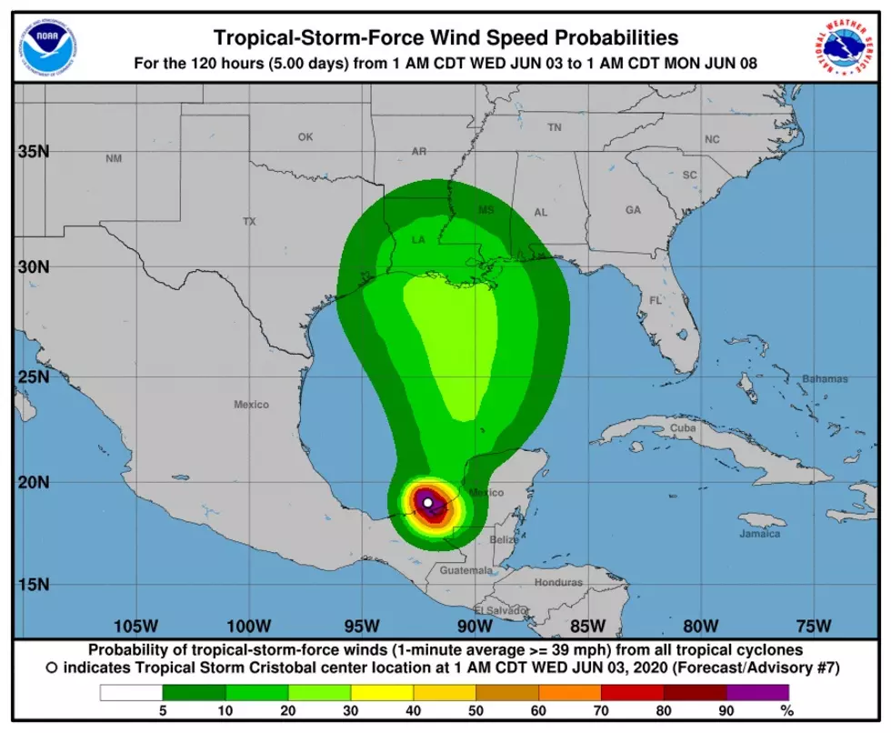
The current National Hurricane Center track has Tropical Storm Cristobal making landfall in Louisiana early Monday morning. Obviously, many things can change over the next few days and alter the path of the storm as it enters the Gulf of Mexico.
However, currently the NHC has Cristobal slamming into the Louisiana coast right after midnight early Monday morning and heading up the middle of our state.
With the storm's current path, Southwest Louisiana will be on the west side of the storm. That's great news for us, seeing that the west side of tropical storms/hurricanes are historically the calmer side of the storm. However, this is bad news for Baton Rouge, Lafayette, and all the towns surrounding them, as currently they're staring at a direct hit.
As we reported yesterday, Cristobal is wasting no time causing tons of havoc in Central America. It appears after slowly traveling through the Gulf all week, it will have a lot of rain to dump on Louisiana, as well.
Looking at the different data and reports from the National Hurricane Center and Weather Underground, it appears the possibility for Tropical Storm Cristobal to strengthen into a hurricane is low. Both organizations have the storm graded as a tropical storm when it makes landfall.
Remember, these are not official forecasts for the storm because a lot could change in the coming days. These updates are to be used for planning purposes for your preparations for the storm.

Popular Television Shows Based on or Filmed in Louisiana
More From Cajun Radio 1290 AM


