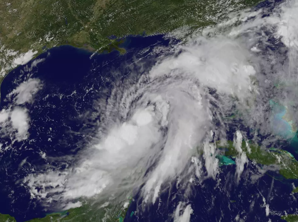
Update: Calcasieu Parish Under Tropical Storm Watch
As of the 7:00 a.m. update, Southwest Louisiana is now under a Tropical storm watch. The cone of uncertainty has shifted further westward which now looks like it includes all of Louisiana.
Update: 7:00 a.m. advisory: The 7 a.m has just come out and nothing has really changed as far as projected path and wind speeds. Tropical Storm Isaac is currently sporting 65 mph winds with gusts up to 75 mph. If you are tracking at home, Isaac is currently at 25.7 north and 84.7 west moving West Northwest at 13 mph. Isaac is located 616 miles East South East of Lake Charles.
UPDATE 4:00 a.m. advisory--- ***Calcasieu, Beauregard, Cameron and the rest of Southwest Louisiana is under a tropical storm watch***Tropical storm Isaac has not really strengthened overnight. Winds are still at 65 mph with gusts to 75 mph now. We encourage everyone to stayed tuned to the radio and here on line and to make sure that you have a plan of action in place just in case Isaac decides to move further to the west. There will be another update at 7 a.m.
***Below is the new map of all the areas of Louisiana that are under watches and warnings.****
UPDATE 10:15 p.m. advisory--- The new 10 p.m. advisory looks like the track of tropical storm Isaac has moved even more to the west and now includes most of Louisiana which could be bad news for us here at home in the Southwest Louisiana area. Isaac is currently positioned at 24.2 North and 82.9 West or 772 miles East Southeast of Lake Charles moving West Northwest at 12 mph. Winds are currently at 65 mph gusting to 75 mph.
We will have complete coverage and updates Monday morning beginning at 7 a.m. right here on Cajun Radio 1470/1290 and on Cajunradio.com
UPDATE 7:00 p.m. advisory: The new update at 7:00 p.m. shows that Isaac's winds have increased to 65 mph and gusts to 70 mph. The track is about the same from the 4 p.m. update but the west side of the cone is covering into the Baton Rouge/Lafayette area too.
You will also see from the above is the picture of the latest track and the forecast making Isaac a possible category 2 hurricane when it makes landfall. We will have updates tomorrow morning on the air and here on cajunradio.com
UPDATE 4:00 p.m. advisory: A Hurricane Warning has now been issued for Louisiana, Mississippi, Alabama and the pan handle of Florida including the City Of New Orleans. Tropical Storm Isaac is at 55 mph winds with gust to 70 mph. Click read more to see the latest warnings. The latest track is pictured above.
Update 3:30p.m.---Louisiana Governor Bobby Jindal issues a state of emergency for the entire state.
UPDATE: 3:12 p.m. Louisiana Radio Network is reporting: With Isaac in the Gulf and forecast storm tracks bringing it in this direction, Governor Bobby Jindal has scheduled a press conference for this afternoon (Sunday 08/26) at 3:15 pm.
UPDATE: 3:10 p.m. WWLTV in New Orleans is reporting: Mayor Landrieu has called a state of emergency for Orleans Parish ahead of Isaac.
UPDATE: 2:45 p.m. -- New Orleans now under a Hurricane Watch. Click read more button to see the watch and warning areas. The next advisory will be out a 4:00 p.m.
UPDATE: 1:00 p.m. advisory
Isaac still a tropical storm with winds at 60 mph and 75 mph gusts. Here is the latest forecast track above. The next update will be at 4:00 p.m. today.
UPDATE: Louisiana and the city of New Orleans under a hurricane warning. See below for all watch and warning areas.
Tropical storm Isaac's forecast is for it to head into the Gulf of Mexico by tonight and become a category one Hurricane.
We will keep you updated on the situation so make sure to check back with us.
More From Cajun Radio 1290 AM


![Tropical Storm Warning Posted For A Portion Of Louisiana’s Coast [Updated]](http://townsquare.media/site/162/files/2017/06/Tropics-June-201.jpg?w=980&q=75)


