Barry Now On Land – 10 am Update
Barry has made its way onto the Louisiana coastline this morning. The National Hurricane Center has the storm officially at a category one hurricane.
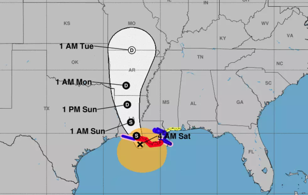
As of the latest advisory from the National Hurricane Center (10 AM CDT) here is what we know about Barry:
LOCATION...29.6N 92.0W
ABOUT 40 MI...65 KM S OF LAFAYETTE LOUISIANA
ABOUT 50 MI...80 KM W OF MORGAN CITY LOUISIANA
MAXIMUM SUSTAINED WINDS...75 MPH...120 KM/H
PRESENT MOVEMENT...NW OR 310 DEGREES AT 6 MPH...9 KM/H
MINIMUM CENTRAL PRESSURE...993 MB...29.33 INCHES
The forecast track continues to keep the center of circulation very close to Lafayette. Based on guidance from the Hurricane Center that will likely happen this afternoon and into the early evening hours.
That being said radar is showing some of the outer rain bands of Barry pushing onshore. With even more precipitation well to the east of the system in Mississippi and Alabama.
Besides sustained winds at tropical storm force with gusts even higher. The biggest threat from Barry will likely be flooding. Heavy rains are associated with this system. Currently, the bulk of the convection, rain, and thunderstorms is on the south and east side of the system.

This means that much of Acadiana can expect rainfall amounts of six to ten inches, isolated locations receiving more, between now and next Tuesday. Those living in the eastern parts of Acadiana might see even higher rainfall totals. The graphic above illustrates where forecasters believe the heaviest rains from Barry will fall.
Heavy rains and gusty winds will likely continue for 24-36 hours even as the system begins to weaken.
More From Cajun Radio 1290 AM


![Video Shows Levee Overtopping In Plaquemines Parish [WATCH]](http://townsquare.media/site/34/files/2019/07/GettyImages-840616746.jpg?w=980&q=75)


![Cindy Hits Cameron, Moves Toward Lake Charles – [VIDEO]](http://townsquare.media/site/149/files/2017/05/ryan-street-flooding.jpg?w=980&q=75)